
Utah Geological Survey and the Navajo Nation Publish a First-Of-Its-Kind Geologic Map

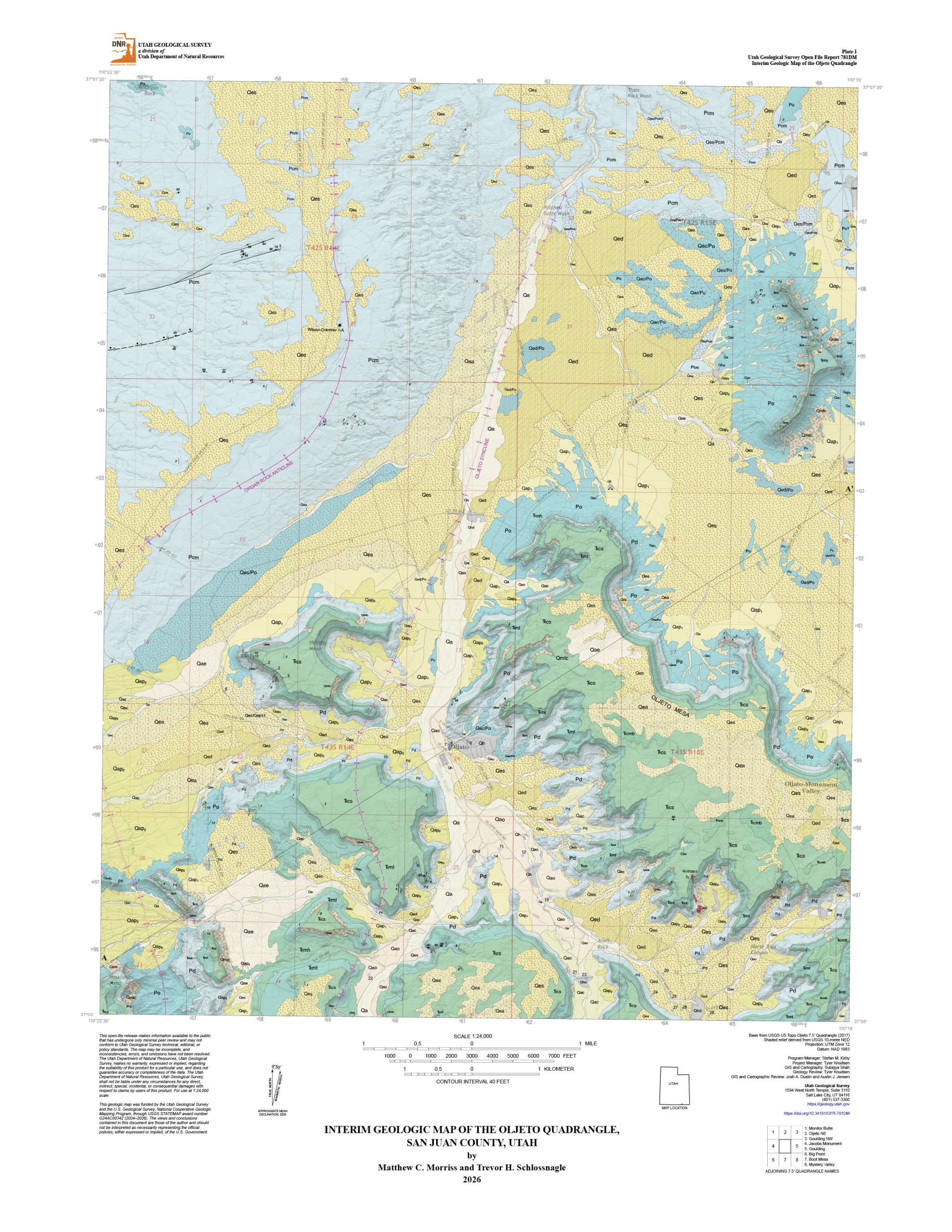
The Oljeto Quadrangle covers a diverse array of geology from sand and stream sediment to the rocks of the Permian and Triassic Periods, which have been gently folded by regional mountain building.
SALT LAKE CITY, UT and WINDOW ROCK, AZ (August 11th, 2026) – The Utah Geological Survey (UGS), in partnership with the Navajo Nation, is announcing the publication of a new geologic map for the Oljeto 7.5’ quadrangle. This map is a collaboration of the Utah Geological Survey and the Navajo Nation Department of Water Resources. It represents the first-ever formal geologic mapping by the UGS within the Navajo Nation, setting a new precedent for how tribal priorities can help guide scientific research.
Unlike traditional mapping initiatives, this project began with a simple question. Prior to beginning its research, the UGS approached leadership and resource managers within the Navajo Nation to ask a fundamental question: What are your priorities, and how can our science serve them?
The answer from the Nation was clear and urgent: groundwater.
The Oljeto quadrangle covers a striking and hyper-arid slice of the Colorado Plateau straddling the Utah-Arizona border, encompassing portions of Monument Valley. In a region where surface water is nearly nonexistent, and development continues to stress local resources, mapping what lies beneath the surface provides critical data to help decision makers take informed action in natural resource management.
Geologic maps act as a blueprint of the Earth’s architecture. By carefully charting the area’s rock layers, fault lines, and sediment distributions, the new map provides the Navajo Nation with data needed to understand groundwater resources, manage existing wells, and safely develop future infrastructure.
“From the start of this project, we knew we needed tribal involvement to ensure maximum value for the Tribe. We are proud to have worked directly with the Navajo Nation to produce a map that helps address their water security concerns.“
— Dr. Matthew Morriss, UGS Project Geologist and Lead Mapper
“Through communication and partnership with the Utah Geological Survey, the Navajo Nation was able to increase technical capacity and resources needed to complete the Oljeto 7.5’ quadrangle mapping project, learn more about the geology in the region and the relationship with the groundwater supply.”
— Dr. Crystal Tulley-Cordova, Navajo Nation Department of Water Resources Principal Hydrologist
Legal Disclaimer:
EIN Presswire provides this news content "as is" without warranty of any kind. We do not accept any responsibility or liability for the accuracy, content, images, videos, licenses, completeness, legality, or reliability of the information contained in this article. If you have any complaints or copyright issues related to this article, kindly contact the author above.
